Monday, March 25, 2013

Outreach Research Project Update

As mentioned previously in one of Cecilia's update posts, we (Ceci and Ian) are researching the topic of evaluating one-off outreach education events. There is a surprisingly large body of research related to this question. In addition to this research we are trying to evaluate our outreach events both here (Malta and Sicily) and back in the states, applying the techniques and ideas from our research.

Ian during an outreach event

As a major part of our attempt to evaluate our own outreach events, we are developing a website to provide followup lessons for the students we teach. This website will contain videos about computer science, links to other resources, and lessons in the form of a simulator which Ceci is designing and developing for a graphics class project.

Now we're moving forward with integrating this simulation into a website and adding the videos and links. In order to develop the website we've set up a temporary web server to try things out online and a locally installed web server for quicker development and so we can still work when we don't have internet access.

In addition to the website for student interaction we're conducting a survey of the teachers for their evaluation of how the students learned in the outreach events. This survey has been completed, set up, and tested so it will be sent out to the teachers within the next week. Our Malta outreach has been completed and we have one more Sicily outreach event tomorrow.

In general, our evaluation process will involve self evaluations which we will compare against the teacher responses to our surveys. We'll also be asking the other ICEX members involved in the outreach events for their reflections both the specific events in question and of ways to move forward with robotics outreach events in general.

With regard to our formal research of the general evaluation topic, as mentioned before there is a large body of research in this feel. We have collected a number of large papers on the subject and are currently working our way through all of them. We'll be writing a report on the different techniques for evaluation along with our specific evaluation of our outreach events, and plan to have a first draft done by the end of the trip.

--

Ian and Ceci

Checking out the University

Today was a great day! Amanda, Andrew, Cecilia, Ian, Spencer, and Vanessa took a trip to the University of Malta to do some touring, research, and interviewing. (And a little shopping, of course!)


Upon arriving at the University, we headed straight to the Archaeology Center to meet up with Dr. Timmy Gambin, who is a Senior Lecturer in the Department. The Archaeology Center was a cool old stone building--something we are definitely not used to seeing at Cal Poly.


Timmy showed us all around the department, including the archive room that is full of archaeological findings and results from years of excavations.


After that, we got to see the student center and some of the buildings. We went to the Engineering Building, and got to check out the different disciplines of Engineering offered at the University here, including Systems & Control Engineering, which we learned about earlier this month from a Professor who got his Ph.D. working in robotics.

We loved all of the views and the courtyards at the campus. Everything was so green!


Then, Andrew went to the library to read up on politics throughout Malta's history and I interviewed some Professors about the Maltese attitude toward their water shortage and plans for addressing it.

On the way back, we picked up some shirts for the Malta football game tomorrow night! We're all really excited. Go Malta!

Sunday, March 24, 2013

Archipelago of Stone

The Maltese Islands have few natural resources; so many raw materials must be imported, with the exception of limestone. The islands are composed of sedimentary rock, which means that they have been formed over millions of years through the process of sediment compaction (Vella).

Examples of Globigerina and Coralline Limestone
Malta’s rock layers can be divided into five distinct types:
  • Upper Coralline Limestone
  • Greensand
  • Blue Clay
  • Globigerina Limestone­­
  • Lower Coralline Limestone


The oldest of these rock types (Lower Coralline Limestone) was formed roughly 35 million years ago, while the newest (Upper Coralline Limestone) was formed only 7 million years ago (Vella). In comparison, the majority of the exposed rocks in the Grand Canyon range from 200 million and 2 billion years in age (Grand).

Hagar Qim Temples
Both types of Coralline Limestone were formed from the skeletal remains of algae, corals, and molluscs. Globigerina Limestone was formed by the compaction of the remains of a single-celled organism called globigerina. It is believed that the ­Blue Clay layer may have been created from detritus deposits from Italian rivers. The Greensand layer was likely formed in a similar manner to the Blue Clay, but at different depths and with different water current conditions (Vella).


Model of the Mnajdra Temple Site
Tarxien Temples
The inhabitants of Malta have been using these abundant resources for thousands of years. We have been fortunate enough to visit several ancient temple sites, which are constructed entirely of stone, including Hagar Qim, Mnajdra, Tarxien. These sites date from 4,000 – 2,500 BCE. This makes them older than Stonehenge and the Egyptian pyramids (About, Timeline). I found the temples to be impressive in both their architecture and scale.

Limestone has continually been used in the construction of many types of buildings and sculptures. All of the baroque churches that we have visited have also been constructed of limestone. All of the fortresses built by the Knights of St. John were constructed with stone. Additionally, most modern buildings in Malta still utilize limestone extracted from Maltese quarries.

View from Fort Manoel
Arches at the gate of Fort Manoel


Coralline limestone is much harder and more durable than globigerina limestone, but this also make it more difficult and expensive to quarry. For this reason, the majority of modern buildings are constructed using globigerina, with coralline being applied in specific areas for additional strength (Cauchi).


Malta has a long history of exporting limestone to other countries for use in building materials and sculptures. Throughout the nineteenth century, limestone was traded with a number of Mediterranean countries including Greece, Turkey, and North Africa (Retention). Limestone has also continued to be an important export from Malta in the modern era (2011). It is exported to several nations in the European Union and elsewhere.


I am interested in researching the other building materials that are currently being used, such as steel and glass. I am interested in discovering whether these materials are now being used due to reduced cost, increased strength, environmental concerns, or a combination of these factors. Finally, I am interested in visiting/researching a quarry in Malta. The team visited two quarries in Sicily, and I found them and their history to be fascinating. I don’t think that we will have time to visit one during our trip, but it will definitely be at the top of my list if/when I return to Malta.

“About Stonehenge.” http://www.stonehenge.co.uk/about.php.

Cauchi, Rudolph.“The Maltese Limestone.” Limestone Sculptures. http://www.limestonesculptures.com/limestone.html.

“Grand Canyon Geology.” Grand Canyon National Park Lodges. http://www.grandcanyonlodges.com/grand-canyon-geology-5451.html.

“Retention of the Status Quo Regarding the Exportation of Maltese Stone.” Ministry for
Economic Services, Malta. 2000. http://www.lino-bianco.com/otherprojects/images/3_exportation/retentionofthestatusquo.pdf.

“Timeline of Ancient Egypt.” National Geographic. http://www.nationalgeographic.com/pyramids/timeline.html.

Vella, Leslie. “Living Stones: a brief guide to Malta’s geology.” Malta Inside Out. http://www.maltainsideout.com/11993/living-stones-a-brief-guide-to-maltas-geology/.

"The 2011 Import And Export Market For Worked Building And Monumental Stone In Malta." Country Trade Reports (2011): N.PAG. Business Source Premier. Web. 24 Mar. 2013.

Stereo Progress

Recently I've been spending time processing the data from our GoPro stereo cameras. I've have written most of the algorithm/backend processing that we need to reconstruct geometry found in the cisterns from stereo images, so most of the remaining work is actually processing the raw images captured in the cisterns to form something called a disparity map. I'll explain more about disparity maps later.

Our GoPro cameras:


I began by working on a set of pictures that were taken above the water surface but were still part of one of a cistern. I have processed a ton of photos now, and this is just one example.

Unfortunately, our GoPro cameras have a bit of a fish-eye lens, which can lead to some complications below the water surface. Last year, Tim and I corrected for this fish eye by dropping a checkerboard pattern into the pool, taking pictures, and flattening the image until the checkerboard was aligned with the dominant axes on the screen. A few other steps were applied to each image before rectification. To the left is an original image from the right GoPro camera.


After doing some basic preprocessing, we attempt to align the stereo images along epipoles in order to aid in stereo matching. To do this, I am using a MATLAB implementation which is freely available.


Here is a composite Red/Cyan image of the left and right images, respectively.


To rectify the images, we search for 'significant features' which can be matched between left and right. Then, we apply a transform on each image in order to align all of the significant features on top of one another. To the right are some feature identification pics. Note that not all features have a match between images. To match features, we do some more processing.


Some SURF features and their weights shown in green circles.
 Once features are identified and refined, we match significant features between left and right images. Notice how the features in each image are slightly offset from each other.


 Once we have features matched, we can apply a 2D affine transform to align the images along their stereo epipoles. This makes the disparity mapping algorithm easier later on (now we only have to search for similar features to our left and right, rather than up and down!).


Once the images are rectified, you can save the red and cyan channels as the new left and right images as input for the disparity matching algorithm. When we run the disparity algorithm, we get something that looks like this. Red things are close, blue things are far!


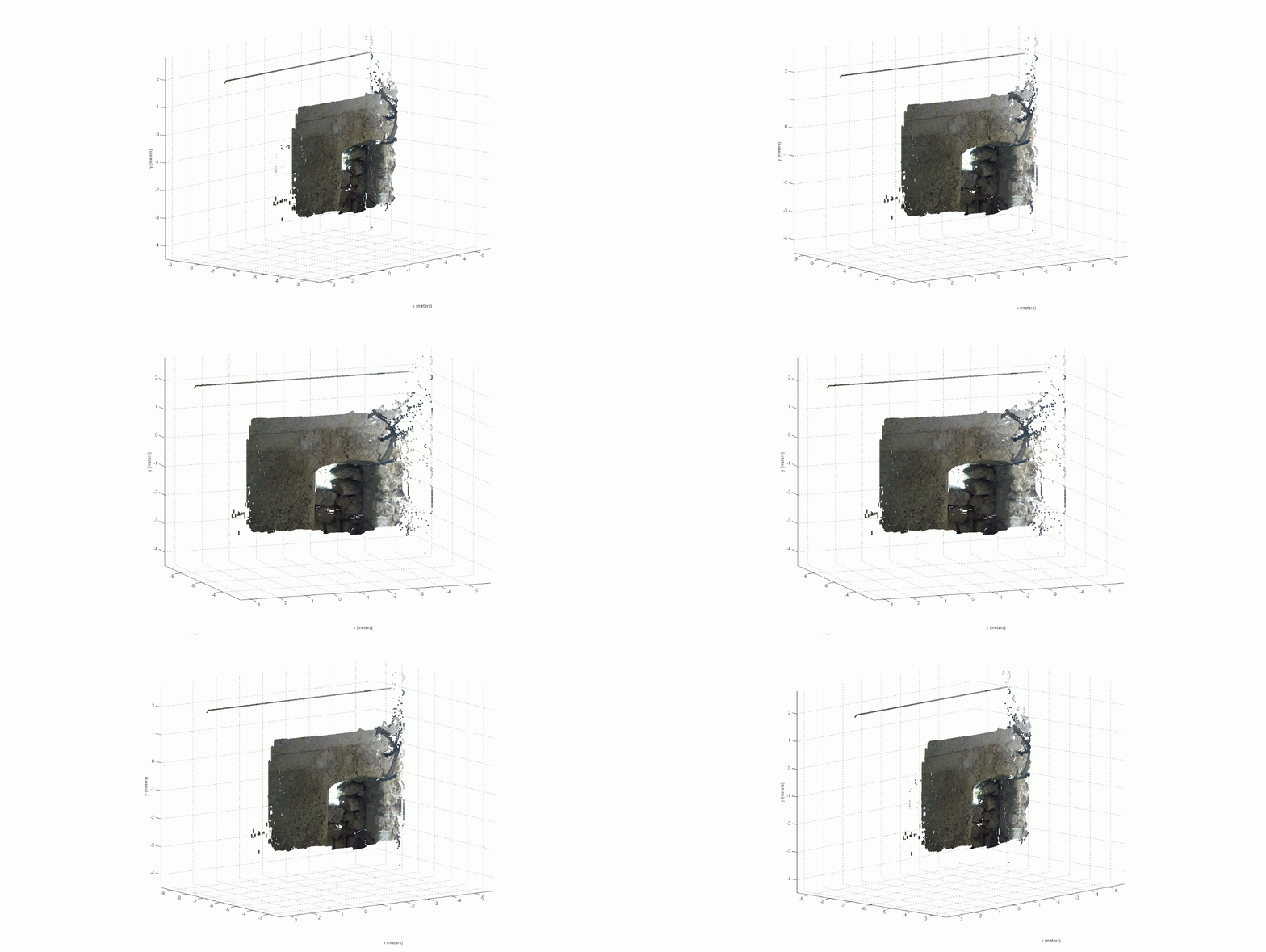
When you get a disparity map like this, you can do some pretty cool things. For example, you can now make x,y,z points in 3D space using the x and y values in the pixel coordinates in the original image, with the z value obtained from the color in the disparity map! Here is a cool example of what I mean.


Today I was able to get all of this processing scripted, so now I can click 2 buttons and process all of the images from a deployment into disparity maps. These disparity maps will be used for some exciting things, including reintroducing medium and fine details back into the cistern which were originally omitted from the low resolution SONAR data! This is just one half of my project, and I have a good deal of the second half complete already. Now it's time to combine the two and get some real-world results!

Sonar Mosaics from Valletta MCC

Quick post:

Here is a cool mosaic of one of the most interesting cisterns we have found on this trip. Lots of work is going into producing 3D visualizations of this one, and I will upload the Blender-fied 3D mosaic within the week before we produce a volume/mesh map!


Saturday, March 23, 2013