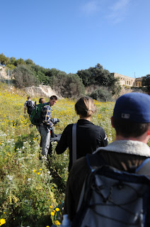
On Monday and Tuesday we visited St. George’s Cave. When we arrived at the cave, we discovered that the water level had risen significantly since the last deployment 2 years ago. The land bridge that had previously connected a large rock hill was approximately 1 foot underwater, so we were forced to setup our control box and other equipment outside of the cave.
 |
| Rock hill on the right |
 |
| More of the cave...Pictures just don't do it justice in scale |
We quickly deployed with the Smart Tether and began taking
sonar scans. It took a couple of hours just to map the outer walls of the cave, and it was lunchtime before we knew it.
After lunch, we redeployed with the HOBO sensor. When we went to put the ROV in the water, we noticed that the water level had risen since the morning. This made us wonder if the cave is somehow connected to the sea. Our
HOBO data may help us answer this question.
 |
| Andrew on tether |
 |
| Tape for our "Slices of Pie" |
We quickly ran into a number of Smart Tether issues. After
about an hour of troubleshooting we decided to begin taking manual measurement
by driving the VideoRay to a wall, marking the tether with tape, diving to the
bottom, and marking again. We kept a log of time stamps and approximate
locations in my journal, in addition to our usual log books. These timestamps
will help us match up the corresponding HOBO data. We decided to call this our
“Slices of Pie” method, since we were taking new readings ever few degrees
around the semicircle cave.
By By the end of the day, we had finished collecting dense HOBO data for about half of the cave. When we returned on Tuesday, we decided to continue our “Slices of Pie” method for the remaining half of the cave. Interestignly, about
1/3 of the cave was blocked from view by the rock hill mentioned above.
 |
| View from the cave entrance |
 Once the ROV software was back up and running, we quickly finished our slices of pie. One of the slices had a deep channel below it. We
dove about 20 meters and could not descend lower, but still saw pitch black
below, indicating that it went much further!
I’m excited to see the results of this deployment. Even with
our manual logging style I am hopeful that we will get some interesting
results.


No comments:
Post a Comment